Friday, August 12, 2011

PSA

SOUTH BERWICK, Me. - Better Great than never: The new bridge crossing the Great Works River on Great Hill Road is open to traffic.

The 75-foot, two-lane span, under construction since December, replaces a 45-foot one-lane bridge that restricted river flow and had dangerously low-visibility approaches from both sides.

Great Hill Road, the next-to-last South Berwick road to be fully paved, has seen increased traffic flow as a number of houses have been built on it and nearby Rodier Rd. This brought attention to the former bridge deficiencies despite the road remaining of limited value as a through route. Bicycle traffic also increased after the road became part of the temporary Eastern Trail bicycle route due to ongoing difficulties with bridging and trail quality on the preferred former Eastern Railroad route.

Time will tell if residents' concerns about faster traffic will be realized. A promised 30-mph posting is not yet present.

Sightlines to the new bridge are significantly better than the old due to its greater width and length.


Attractive chunks of granite brace its southeast side.


The wider channel between the new bridge's piers allows the Great Works to flow at its typical languid rate.


The one-lane bridge and its quirks will be missed, but the newness in relative emptiness has its own attraction. As an added bonus, a spilled something on the SW side of the bridge allows passers-by to play Name That Splotch.


A melting Pac-man ghost? Sighted stormcloud? We report, you decide.


Sunday, August 7, 2011

Introducing....


Starting soon, Main Streets and Back Roads will be spending a day in each of New Hampshire's 13 incorporated cities. We'll look at history, attractions, restaurants, natural features, and of course transportation. It's fun to research things to do, but even more fun to take others' recommendations. Ideas? Leave a comment!

Saturday, August 6, 2011

KCMO - Saturday and Sunday

Continuation of this entry. It's mid-July in Kansas City - very hot and humid, but with AC everywhere.

You don't think about jet lag when only flying to the Midwest, but an hour is an hour so I crashed and woke up early. Looking to make hay before the sun shone, I happily discovered that I was close to the Burr Woods Nature Center. I don't have many rules, but one of them is that when I'm staying in a random suburb and that suburb has "a favorite hiking trail" of the home city, I have to go hike that trail at the earliest opportunity. So, it was off to the Bethany Falls Trail.

It was already 83 and humid when I hit the road around 7:00, ridiculous but not so hot that you couldn't just sweat and forget about it. At first, the trail was very unimpressive and I grimaced at the thought of it being anyone's favorite. The trail was well-maintained and the forest was nice enough, but there wasn't much going on. This was a highlight from an "outlook" from forest into more forest.


Eventually, I came to some really cool limestone outcroppings. Outlaws once hid in these formations to escape the law. I only managed to get blurry photos.


Couldn't you see people successfully hiding around these? I sure could! Images of the land with fewer trees and more grinning rascals quickly coalesced.

After finding my way free of the limestone, I looped back into some prairie meadow.


It was incredibly peaceful. There's just something about meadows.

On the way back, I was held up by a few deer.


Then, I mistakenly offended a fit old couple by talking too loud with the deer within earshot. Oops. Fortunately, this sign brought on more than enough warm feelings to push out the embarrassment. I'd love to visit this site periodically to monitor restoration progress!


I admitted to writing the trail off too soon. Still, I'll take New Hampshire, and I don't think that'll offend many Bethany Falls fans.

Before retreating to the AC, I wandered down to the I-70 overpass near the motel. This had pretty much blown my mind when I stayed here last year and gave me a bit of a shock this time as well.


The overpass is I-70; the lower road is MO-7. I've never seen bridge piers between two lanes of a road before. Exiting I-70 East to the state road north, there are two left-turn lanes at the end of the off-ramp. One goes to the left of the pier, the other to the right. Pretty crazy. My dad speculates that the bridge was built when MO-7 was just one lane each direction and they didn't bother to replace the bridge when MO-7 was widened. Makes sense.

Soon, I headed back to Independence to the Harry S. Truman library and museum. I guess it's too well-known to be a fun fact, but the S in Harry S. Truman stands for nothing. It was just considered to more dignified than no middle name.

I had a great time! The museum seemed to have been built around the goal of showing the public that it's tough to be President, mainly because of all of the tough decision that nobody else can make. There's nobody to pass the buck to. Lord knows I pass the buck often enough at work, so the point was well-taken.


Harry S. comes out looking pretty good, but not perfect, and there's a lot of good 40s/50s and general Presidential history along the way. Did you know that James K. Polk was constantly exhausted because he handled most White House correspondence himself? No wonder nobody remembers him - he was too busy with minutiae. I wondered what curious choices our other presidents had made and wondered why I haven't already read biographies of each and every one.


I'm pleased to make the Truman the first presidential library to receive a Main Streets and Back Roads endorsement. America, f*** yeah!

Invigorated, I skirted downtown and followed Marla's directions to a used bookstore on a commercial strip. It wasn't 90% romance novels, as had been reported, but it was pretty close. All I needed, though, was one copy of Blue Highways; three weeks later, it's already a landmark read.

I changed in a school parking lot and enjoyed the wedding more than I'd expected to. Two Swarthmore alums who I thought didn't care for me were perfectly nice and even saved me a seat. Hopefully I'll remember this next time I have occasion to over-generalize and worry based on third-hand reports. The surprisingly good terms continued at the reception, followed by a quality night of dancing. Almost everyone danced, wine was free, and the DJ played the Cupid Shuffle. Not surprisingly, Alicia killed her Maid of Honor toast. The mood was so good, the 90/humid for the walk back to the hotel was only cause for more laughter.

By Sunday morning, I was feeling comfortable on the road again and hummed my favorite travelling song - also my favoritest favorite Rush song - in the shower.

After successful goodbyes back in Independence, the return trip to the airport was an adventure best forgotten, but we did get a few quality minutes at historic Union Station. It's a major train station rehabilitation success story.


The flight home was uneventful and, after the usual "is the C&J convenience worth the wait?" hemming and hawing, we made it home safely. Would I have remembered however I'd have killed an extra hour or two, anyway? Doubtful. It felt good to have traveled and I was pleased Asheville was only two weeks away.

Friday, August 5, 2011

The Punk Meets the Godfather

I don't drive 95 north into Maine very often anymore; there's little need to when Dover centers the universe. Last night, though, I went spoke-to-spoke from work to Jim's house in Wells. It being the heart of summer, I avoided Route 1 as always.


There are just so many memory lanes along this route. The first segment, along Chases Pond Rd, brings to mind feelings from the summer of 2007, the first period I drove it regularly. At that time, I was working full-time in Exeter and part-time at Wonder Mountain. Fretting about whether I was working too hard or not hard enough and why I cared so much. Coming down with and getting over mono. Trying to put into context the prior fall's relationship and spring's other. Holding out for Rock of Love / Pirate Master Tuesday nights; we were all working too much to see much else of each other. Excited for...actually, not all that enthused about what was next. Mostly, self-awarely trying to capture some "carefree summer" feel and shut out all of the "what's next?" of starting senior year. 40 minutes of commute each way offered way too much time to be melancholy.

Chases Pond is actually a nice road, passing through some set-back houses on good-sized lots and eventually some York Water District land. There are still a couple of anti-tollbooth move signs up at houses that could be wiped out by such a relocation. I remember more signs back when "the tollbooth is sinking!" was fresh; perhaps outcry has died down since there seems to be a good option that doesn't displace any homes. Still, it's funny how things go from urgent to out of the news; of course, sometimes they resurface with a vengeance.

There are also two opposing "Drive like your kids live here" signs. These exasperate me, but I've yet to find a retort that doesn't make me feel like a jerk. Any ideas?

The route jogs right onto Mountain Rd then left on Greenleaf Parsons Rd to continue paralleling the highway. Not much there. A similar jog right onto Agamenticus Rd (this one comes out at the blinking light in Ogunquit just north of the playhouse) and left onto Josiah Norton Rd, which parallels the more often used North Village Rd.

Remarkably, I am the center of a three-car sandwich on Josiah Norton and pass three cars going the other way. It's remarkable because one of my earliest memories is Dad taking me over when it was a barely passable dirt track passing just one house. Through the years, I tracked new construction and paving activity. After dad moved away from the area, it became a near-ritual for me to drive the road every six months and report on what was new. This summer, I found that it was paved all the way through; Emily later said this was actually done last year while I was out west.

These are pretty positive memories. I have to try to really hard to achieve a "another dirt road bites the dust :-( :-(" feeling and it's not very convincing. Still, it's a lot of work to be a road's historian.

Two new additions are one of those solar-powered highway signs on wheels and a spray-painted plywood sign. The former says "CAUTION SLOW DOWN" and the latter "Drive Slower". I hope the plywood sign was put up by someone who had loudly requested that the road be fully paved. It's like Bennett Lot Rd in South Berwick - what the heck did people think was going to happen? People driving fast on a shortcut back road with a new surface and not a lot of houses - shocking, although I keep it around 35 as I still half-expect the surface to turn to dirt.

As an aside, the road passes near the Josias River; my guess is that Josias is a shortening of "Josiah's" but can't find anything on who Josiah Norton was.

Berwick Rd and the northern section of North Village Rd are benign; the primary memories are of long-ago bike rides.

Tatnic Rd, the main road from my mom's house to inland Wells, brings all kinds of memories. Perhaps the strongest were of the summer of 2004. I was smack-dab in the middle of my Wonder Mountain career and learning (not very well) how to manage people, particularly those older me. Enjoying, and drawing strong feelings from my first relationship, which became my first serious relationship. Getting as much as possible our of the few weeks before Kryzak had to leave for Air Force Academy boot camp with the sense that it may never be this good again. Worrying about starting college like everybody does. All good things, but so emotionally wrought.

I was struck strongly by how we gain and lose ownership over public property. In and around high school, we feel invincible; connected to that power are feelings of having the deepest possible connections to the places and things we care about. No other driver appreciated that stretch of road quite like you did that one sunny spring day with the windows down. No other walker enjoyed that stretch of woods road like you did when you spotted that chickadee or shared a smooch.

I imagined meeting current high-schoolers who drive the Tatnic Rd route, telling them how I used to drive it all the time, and having them think "Yeah, whatever." It's their road now. In some ways, they have far more right to it than I ever did. Red, yellow, and green spray paint adorns one tree where there was a fatal crash. I know about that one, but I soon see a similarly-painted tree on Hiltons Lane. Was there another fatality that I didn't even hear about? My clear loss of grip is momentarily shaking. Not only do new kids have as much reason as me to love the roads every year, some have indisputably more reason - and I don't even know why.

I'm a dinosaur and this hunting ground is tapped out. Time to move on. Fresh, strong memories of a great few days in the new, infinite space of Asheville, NC and points west only enhance the wanderlust. It's fatiguing.

Of course, there are ways to fight back. I put on Quadrophenia, a longtime favorite with so much left to give. The storyline (the mental and physical journey of a rebel youth) has a familiarity and happy ending that is easily grafted onto my own constructed story. And then there's the physical release of drumming along with Keith Moon on the steering wheel.

I love Wells, I don't go there often, and I know I can move somewhere totally new when it's time to. It was a nice ride on some pretty back roads, and lord knows it was better than sitting in Route 1 traffic.

Monday, July 18, 2011

KCMO - Friday

Last weekend, I joined Alicia in Kansas City for Megan Schuster and Adrian (Adi) Vasile's wedding. Megan and Alicia were great friends, often as roommates, throughout college and have maintained an easy, close friendship since then. Alicia was thrilled to be Maid of Honor and I was a happy hanger-on.

Alicia planned for months, pulling off parties and puffballs and surviving a flip-flop crisis. I did little ahead of the night before my flight, when I rounded up various destinations on a not-to-scale map.


It got away from me a bit as there kept being more places to mark, but it did the job. Still, I plotted a trip to AAA (opens at 8:30) in Portsmouth just ahead of the bus to Logan (which left at 9:00). I love when things like that work out.

Friday got underway with Juke Box Hero, a Rock Band classic. I took it as a good omen. After skulking around the sketchy parking lot by the closed movie theater and trading in the originally-proffered map of Kentucky, I comfortably made the bus with state and city maps in hand.

C&J Trailways has always been a tough one for me. Pristine, but expensive. Convenient, but scheduled. It beats paying Logan parking prices, but ultimately I'd prefer a lower-frills / lower-cost option. This time, I did enjoy the ever-looping black-and-white TV episodes, eventually realizing that it was that weird Addams Family show that used to come on before Saturday morning bowling. Now, I can't get enough of that John Astin grin.

At the airport, I finally had time to sit in one of the sweet rocking chairs.


The view was pretty nice. As always, I wondered who bothers to stay at a Hyatt this close to the airport.


We were lucky. Discount carrier Frontier Airlines flies only two routes to New England, but one is a Boston<-->Kansas City direct. A three-hour flight for under $100 - not too shabby. With such a small presence, Frontier has a gate-sharing arrangement with US Airways Express. They used equipment that I thought carried a long-defunct brand, but I was mixing up Midwest with Eastern Airlines. Midwest also no longer exists, but did until very recently; they were merged with Frontier under the latter name. I later found out that the warm cookie presented as a Frontier trademark was actually stolen from Midwest and has a rich history.

I thought I was flying to MCI, but the airport marketed itself as KCI. Understandable, but the official explanation is pretty weak - call us KCI, even though it's not a legal airport name. Not many cities start with the disallowed letters of K, N, or W, but note that Newark, for example, is stuck with EWR. Whatever the letters, I was in the city of fountains!


I grinned, remembering Bill James's 1986 essay about how his home city suffered from its insecurities, obsessively comparing itself with luminaries such as Rome and New York and always looking silly as it came up lacking. He compared this to the sad saga of the Kansas City Athletics, who made a number of suspicious trades with the New York Yankees en route to recording 0 winning seasons in 13 tries during their time in KC.

MCI Terminal C was air-conditioned to the point of chilliness, I waspishly noted the energy overuse. I ate my words a bit after stepping outside. It was mid-90s and very humid all weekend, barely reaching 80 at night. Highly unpleasant, to be sure, but it's easy to overstate the unpleasantness - it was comfortable unless you stayed out in the sun long enough to start sweating.

I get to be a member of National's "Emerald Club" through work and was genuinely pretty excited about having my pick of the "Emerald Aisle". Last time, I got a sweet Chrysler 300! This time, the pickings were slimmer but I was pleased to have a chance to drive a Jetta, what with all their clever advertising over the years.


The instrumentation was slick, but the acceleration was odd, with a gap between hitting the gas and getting sound or RPMs from the engine. Also, it had small side mirrors and my pet peeve of flimsy, small sun visors. I'll pass, but thanks.

There were clear stations all over the FM dial, but (not surprisingly) most were country, conservative talk, or religious. Fortunately, I soon settled into a blues show on KKFI. The excellent Friday Night Fish Fry was a standout. I love to party!

My prior trip across Kansas City, last September, featured tornado warnings and very real thunderstorms. This one was a lot more peaceful, even at rush hour. Nothing slow until some lane closures on I-70 east of town, and even that wasn't too bad. Getting to drive under a cable-stayed bridge similar to Boston's gorgeous Zakim Bridge had me grinning widely.


KC has a pretty clean grid which continues into Independence despite the interruptions of I-435, train tracks, and a waterway.


The grid made it very easy to find Megan's mom's house. I was pleasantly surprised and relieved at being able to exchange warm greetings with everyone; it had been a while. After we prepared the girls' night entertainment, I checked into my trusty (twice in a year - yeah, we're going with "trusty") America's Best Value Inn one city east in Blue Springs.


The rehearsal dinner was in downtown Independence; I passed a number of near-mansions on South Main along the way. Downtown seemed odd; it was a bit quiet, but I think what got me was the lack of any tall buildings. I'm not sure any were over two stories. At home, many small cities have old mill buildings or are tourist towns with hotels that are, if not huge, at least a few floors high.

Dinner, a BBQ buffet, probably fell short of great but the brisket, pork and all the fixings were more than good enough. We sat with old friend Meg and a high school friend of Megan's named Marla, who was a great conversationalist, knew her field/passion (art) impressively well, pointed me towards a bookstore, and even claimed to have heard of Bill James. As Alicia would say, a great random dinner companion for a guy like me.

We lingered after dinner, talking to Adi's Romanian parents in French with varying degrees of success, and it was dark by the time we left. The moon was full, huge, and yellow; even the motel bright lights could do little against it.


Inside, the AC worked and the Royals got a game-winning homer from Eric Hosmer before I passed out nice and early. It felt good to be back on the road.


Wednesday, July 13, 2011

Pretty Persuasion

I just can't get enough of the title song - mellow songs that pack a punch are so cool!

Some Sporcle quizzes for New Hampshire fans:

Name the state's incorporated cities: http://www.sporcle.com/games/itchynip/nh_cities. This one is a doozy. 10 is a good result, any more means you've studied this before or are a freak.

This one is an amusing sideshow to the above: http://www.sporcle.com/games/hawkeye2/nh_largest_cities. I think the creator just picked off the top 10 cities in population, but it's funny to see Claremont and Lebanon classified as "major" while Somersworth, Berlin, and Franklin are left out. I prefer to think of it as the NH-120 connection running deep.

A hard one, but you'll learn something: http://www.sporcle.com/games/Athena13/the603. For example, I had no idea that "demonym" means "the resident of a locality". Too bad New Hampshire doesn't lend itself to something like "Mainiac"; apparently "New Hampshirite" is the best that can be done. At least it sounds like a rock.

Tuesday, July 12, 2011

A Matter of Time

Going from softball games on Stackpole Rd to The Loft, our postgame haunt, has always been a little annoying.


I guess it doesn't look all that bad on the map, but who wants to take a zig-zag route and have to negotiate Weeks Crossing? Happily, there is now a better solution.


We're making the jump to Satellite View to show that there's a sizable pond just off "Willand" behind Hilltop Fun Center. Who knew? Actually, there are some dirt roads heading in its direction; a truck pulled out of one of them tonight.

Earlier this year, "Willand" was passable, but in terrible condition between Hilltop Fun Center and Penny Lane. Having to dodge holes in the road made it no faster and not even any more fun than going around. The road now has fresh pavement to the Penny Lane intersection and is in great shape.

I've taken this route a few times and have always left High St (NH-9) at the light by Irving at Commercial St. Tonight, another driver showed me a shortcut - just take Penny Lane (it's signed) by KFC / Taco Bell. It could be a tougher left turn if you're coming north. Also, beware of the left turn onto New Rochester Road (NH-108) during busy times. Late evening, when our games end, is not busy; we've done a time trial and Penny / Willand is a hair faster than the default.

I like three things about this route:

1) Random pond
2) Coming from 1o8, it passes by a karate studio and promptly dead-ends (unless you turn right).
3) Who had the chutzpah to suggest the name Penny Lane, anyway?

Happy corner-cutting!

Poll

Giant Dover birds-eye view at the top of the blog: yea or nay?

Monday, July 11, 2011

Another Round

We lost the mountain man to insomnia and got to bed late. But, we're starting to get in hiking shape and had the benefit of the invigoration unique to spending time with a fun new friend. There was a crackle of promise as we took the same route as the prior Saturday, give or take five extra miles at the end.

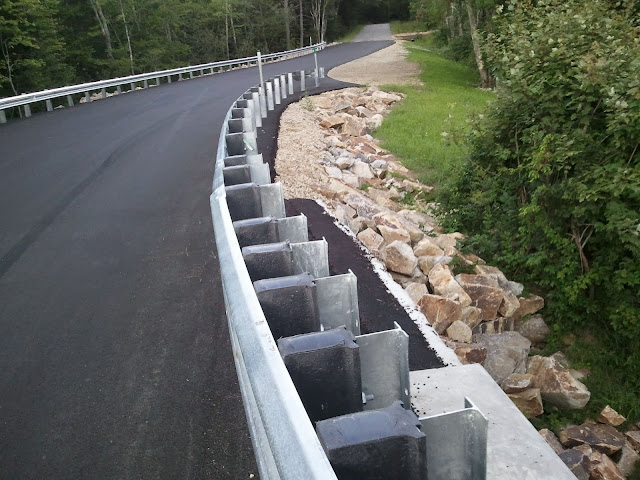
West Side Rd in Conway and Bartlett may be the prototypical combination main street and back road. What's a better choice?

I have history with Mt. Carrigain. A trip with dad in 2000 was the first where I didn't reach my goal. Looking back, it's easy to come up with good reasons why - two unexpected miles on the closed access road, all heat and no breeze, dad's mistimed stories of heat stroke, common sense. Viscerally, it sucked and I was very satisfied when we successfully summited a year later. Tuffsy and I returned on a bluebird day in 2007 and took a longer ascent route around the base of the mountain and up the back side. A great combination of woods walking, history, and challenge. I was all smiles when Alicia indicated that she was up for the longer walk.

We snagged one of the last spots in the ~30-car lot and played rather stressful leapfrog with a group of determined young men for the first mile and a half before turning right onto the solitude of the Carrigain Notch Trail. We would see only five people over the next 6.6 miles.

I recounted the tale of that 2007 hike - the blocked road to Mt. Jefferson, "settling" for Carrigain, the awesome route, the satisfaction of being able to speak about the area, my 21st birthday party up at the camp in Acton that night, the four more days of fun that followed, and the "90 hours in nine days" (but who's counting) stretch to close out my Wonder Mountain career. The trail generally followed old logging roads through mixed woods with good footing as the masses of Carrigain / Vose Spur and Lowell / Anderson squeezed us into the notch. Alicia aced a few moderately difficult water crossings.

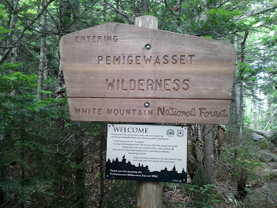
The height-of-land (what a cool word) has boulders, slide views, thick forest, the satisfaction of a completed climb - a wonderfully wild place. Down the other side, we soon entered the Pemigewasset Wilderness; its border follows the ridgeline separating the Saco and Pemigewasset (later, Merrimac) drainages.

Federally-designated Wilderness is controversial as it places great, permanent limits on land use and is mildly riskier for the unaware than garden-variety National Forest. I'm generally a fan since the lower level of trail maintenance helps me feel a little more "in the wild". The boundary signs don't hurt, either.


The challenge of administering Wilderness was soon evident as we came across some removed blazes. Trails in Wilderness are not supposed to be blazed, but how do you deal with blazes that were there prior to the Wilderness designation? The results of removal aren't pretty, but well-applied blazes take many years to fade. It's a knotty issue.


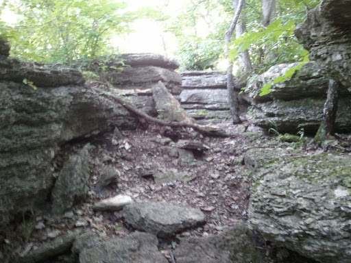
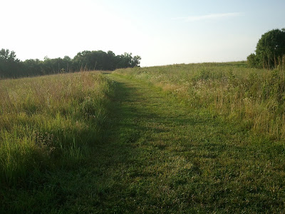
Soon we came across the "Oh yeah!!!" section of Carrigain Notch, where ferns and shrubs line the trail instead of trees. Unusual terrain for the Whites, and thrilling to stroll through.


A while later, we swung left onto an old railroad grade. You could tell it was a railroad grade rather than just a road because the guidebook says so, but also because 2) It was wider, straighter, and on flatter ground than a logging road and 3) It was built up into a real road more so than any logging road. Visible old railroad ties (not pictured) were only the clincher.


According to the excellent J.E. Henry's Logging Railroads by Bill Gove - one of two authoritative books (C. Francis Belcher's Logging Railroads of the White Mountains is the other) on the logging history of the region, the region was logged from 1907-1910. So, while recovery was gradual and many fires followed until the leftover slash was depleted, some of the trees in the area probably recently celebrated their 100th birthdays. And many more!


The East Branch and Lincoln logging railroad was the main line in what's now the Pemi Wilderness. We passed near the former Camp 20 - just scratching the area's northeastern surface.


Some elevation gain was long overdue and eventually we turned left off the railroad grade and into the mountain. Another layer of the area's history is Mt. Carrigan's use as a fire lookout tower. In the heart of the White Mountains, a watcher could spot a blaze on nearly any of the region's notable peaks and plenty of its valleys. The tower has been decommissioned for old telephone wire that served the tower is still visible at times next to the Desolation Trail.


The tower was built in 1910. I can't find a decommission date, but many similar towers stopped being used in the 1960s due to the increasing use of air surveillance by helicopter. Use of choppers has since declined, but funding for towers, while somewhat stable, has never come back in vogue. Some are still staffed by dedicated but aging volunteers. There's a fantastic memorial near the tower on Mt. Agamenticus to those who have staffed it and two other southern Maine towers.

I just said that the climb could no longer be avoided, but we sort of did - a 1.3-mile deficit deal, so to speak, but finally it was time to pay up.


It quickly got less steep over time and we were well warmed-up, so it wasn't too bad. A spirit-raising encounter near the top helped, too.

Wide-eyed woman: [Distant laughter]
WEW: [Loud laughter]
Handsome white dog: [Walks up to us]
WEW: "Whoa! There are some people coming up!"
Me: "We haven't seen anyone in a while!"
WEW: "We didn't think there'd be anybody on this trail!"
Me: "There was one threesome, they were going to turn around..."
WEW: "NO DON'T TURN AROUND!!! You're almost there!"
Alicia: "Oh no we're not turning around, that was them."
WEW: "OHHHHHH okay!"
WEW's companion: [Chuckles]
Me: "Haha yeah....well, you're in for a treat..."
[Euphoric LOVEFEST about Carrigain NOTCH and FERNS]
HWD: "Woof woof!"

At the summit, we touched up at the survey marker and climbed the tower. It was rebuilt for view-seekers after the firewatcher's cabin was taken down. The views spanned mountain scenery,


civilization,


and popular culture.


We spent quality time both atop the tower and on the less-windy summit rocks. There was nothing to do but be content.


Eventually, we said goodbye to the Pemi.


Early in the descent, we caught one more glimpse of the tower.


The descent was rocky and went on a bit longer than it needed to. My trooper companion endured the piece of glass in her foot without complaint, and there were some bright spots.


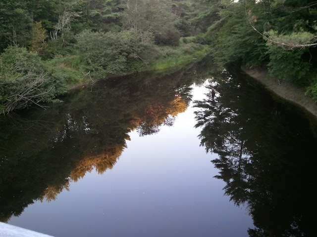
Back at the car, we stayed on last Saturday's course, including the Milton Mills back way, all the way to salmon and veggies at Jim's with my mom. Not even being pulled over for a burnt-out headlight on the way back to Dover could dampen our spirits. Okay, maybe for a little while. But, after two years of too much talking and not enough hiking, it felt great to relearn why I always say I love it so much.

Wait, a sappy sum-up and we didn't even mention the abandoned logging village of Livermore? Oh man, oh man...

Tuesday, July 5, 2011

Everybody Knows This Is Nowhere

We conked out around 7 on Sunday night so Monday started as the best of both worlds: early and well-rested. It promised to be a scorcher, so we hastened through some much-needed cleaning before the sun warmed things up too much. Our apartment gets a ton of sun and thus very hot; hopefully in another few years, if we're somewhere similar, I'll be over myself enough to just get the damn AC unit. Soon, we headed down to the water, hoping for some breeze.

I commute over the Little Bay Bridge and watched with interest through the early spring as the bridge it replaced, the General Sullivan, was worked on through the winter and early spring. Cranes shifted by the every few days and spindly new paths grew towards landfall in Newington and Dover.

Why? The work actually had nothing to do with non-motorized traffic - which was temporarily left without a link between Newington and Dover -and everything to do with the Little Bay Bridge Expansion. Believe it or not, there's room to fit a new four-lane span between the two current bridges. Construction of the center span requires the space used by the former General Sullivan approaches, so new approaches needed to be built off to the side. The center span construction will last well into 2013 and promises to be interesting.

Already, machinery is starting to be put in place to build the new span. The Hilton Drive underpass of the Little Bay Bridge, connecting the two sides of Dover Point and Hilton Park, will probably remain closed for a couple of years.


The roadway on the bridge is vaguely reminiscent of The Road, but that world was never this sunny. I have a memory of driving across the bridge, but it closed in 1984 so it's a false recollection.


Great Bay was full of boaters; a few struggled with the stronger-than-ever tides but most powered through with incident, some with a little help from a larger friend.


There were a mildly unnerving pair of signs on the Newington side, even though the section wasn't close to capacity.


There was a nice breeze on the bridge, and it was fun to watch the cars and boats, so we hung out until it was time for Alicia to go to work. On the way out, I noticed an old sign - a relic of the days when the Spaulding Turnpike was at times un-numbered and NH-16 was the local alternative (today's Dover Point Rd, for instance) between Newington and Rochester. I noticed on my way home from work today that there is at least one similar sign east of the highway in Newington, but there must not be many more.


I can't find a date for when the numbering switched, but I think it was sometime in the early 1990s. There was a ripple effect: NH-125 was extended northwards from Rochester to northern Milton to replace the old 16, NH-108 was extended from its intersection with Dover Point Rd through Dover and Somersworth, all the way to Rt 125 in Rochester. Dover Point Rd lost its state highway designation, and Old Rochester Rd ceased to be NH-16B. I think Rt. 33 was modified as well.

Today, the NH-16 vs. Spaulding Turnpike lives on for one brief stretch: ramps to / from I-95. This is visible both north- and southbound, but is most obvious southbound, where Rt. 16 is signed as leading to the traffic circle and the Spaulding takes you to the interstate. My guess is that this is to establish unique names for 911 caller location.

After Alicia left, I spent some more time in the relative cool of the park, picked up CSA veggies, and eventually joined the crowd at Henry Law Park for the Dover Independence Day celebration. The band, Locksley, played pretty good pop songs with nice vocal harmonies but seemed to struggle to find energy; the crowd was understandably more there to have fun with family & friends than for the show. A medley of "Last Night" and "American Girl" stood out for being a cool and unique similar-songs connection. I got a good start on a promising book before it got too dark to read and fireworks from all around served as taps for the holiday weekend.